LIRLAP - Linking Disaster Risk Governance and Land-Use Planning: The Case of Informal Settlements in Hazard Prone Areas in the Philippines
Project duration:
07/2019 to 02/2021 (definition phase),
03/2021 to 02/2025 (research and development phase)
BMBF research project on strategic risk reduction of informal settlements against natural disasters
Worldwide, rapid urbanization of urban regions is contributing to an increase in disaster risks. The phenomenon of informal settlements in hazardous areas poses a particular challenge. In the last few decades, the global south has shown only a few locally based approaches to resilient planning that have led to real problem solutions.
Metro Manila (pilot study) is vulnerable to natural disasters (particularly floods and flooding) and has for long dealt with the problem of informal settlements. The project builds on the previous six-month initiation phase (November 2017 - May 2018, with a stakeholder workshop in Metro Manila in February 2018) and the 18-month definition phase (June 2018-December 2020, with two stakeholder workshops in February and October 2020). Based on the evaluation of the definition phase, a four-year main phase in the form of a research and development phase (3/2021-2/2025) follows.
Goal
LIRLAP intends to contribute to the following discussions:
- Dealing with disaster risk through spatial planning, especially in settlements that are hardest hit and least equipped with the formal system of risk-reducing planning mechanisms.
- Strengthening resilience while focusing on reducing social vulnerability. Since the most vulnerable people live in informal settlements, their livelihoods are at the heart of the interventions examined.
- Support mainstreaming to promote implementation and translate scientific knowledge into capacity building, policy advice and transferable knowledge.
- In addition, a joint doctoral program and training courses for planning practitioners will be developed to improve local solution capacities.
Based on this background, LIRLAP has developed six work packages for the research and development phase (3/2021 - 2/2025), which were assigned to technical expertise according to the LIRLAP cooperation partners:
- WP 1: Risk trends and relocation options with urban growth (Head: LMU; partner SURP)
- WP 2: Resilient upgrading (Head: IRPUD, TUDO, Prof. Dr. Stefan Greiving)
- WP 3: Resilient resettlement (Head: IREUS, University of Stuttgart, Prof. Dr. Jörn Birkmann)
- WP 4: Mainstreaming of upgrading and relocation strategies (Head: LMU, partner USTUTT, SURP)
- WP 5: Capacity building (Head: IRPUD, TUDO, Prof. Dr. Stefan Greiving, SURP)
- WP 6: Project Management (Head: IRPUD, TUDO, Prof. Dr. Stefan Greiving, Partner SURP)
All WPs are carried out in close cooperation in real laboratory formats with the local partner SURP (School of Urban and Regional Planning, University of the Philippines) - as the central scientific institution in the Philippines in the field of urban, regional and environmental planning and a long-term cooperation partner in the context of SPRING Program - processed as well as partial work packages in WP 2 and 3 also with the partners in Thailand (Urban Futures & Policy Research Unit (UFP) of Thammasat University Bangkok) and Vietnam (Faculty of Land Management of the Vietnam National University of Agriculture). Kaiser Ingenieure plays a leading role in the development of the pilot studies in WP 2 and WP 3 and in WP 5 in training courses and doctoral workshops.
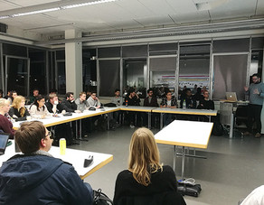
Another workshop (workshop series for each work package) in Metro Manila is already planned for July 2021.
Cooperation partner
Department of Geography, Ludwig Maximilians University Munich (LMU), the Institute for Spatial Planning and Development Planning (IREUS, University of Stuttgart) and the School of Urban and Regional Planning (SURP), University of the Philippines.
Funding and duration
The project is financed by the BMBF (The Federal Ministry of Education and Research) as part of the "Sustainable Development of Urban Regions" funding program and has a duration of 48 months.
You can find a brief look at the photo documentation for LIRLAP in the following file attachment:
- LIRLAP Photo-Documentation PDF (1 MB)


